
UnconTROLLed
perfection
Not sure where else to post this, but since many UPSers along the east coast are dealing with an impressive winter, it's time (for me anyway) to start digging up some science and seeing what "could" happen as we end winter.
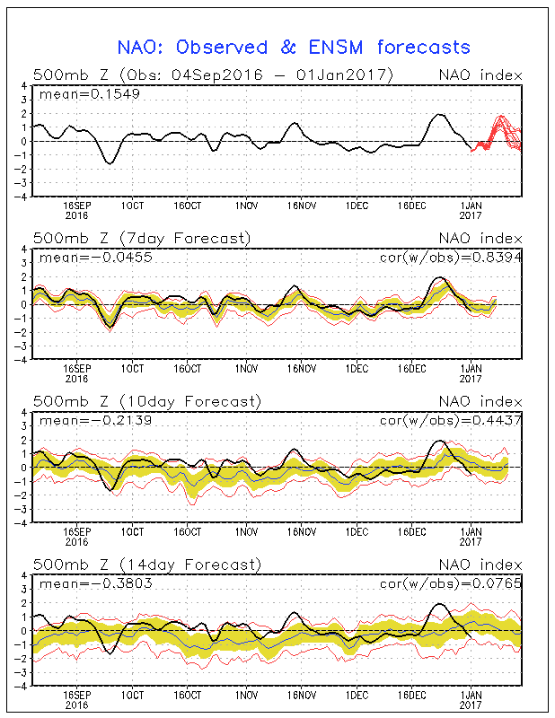
First of all, a massive -NAO block will be occuring in the coming week-two.
What is the NAO? Laymens - It is a statistical climate indice used to measure upper-air temperatures between Greenland and the Azores. When positive, it generally indicates lower than normal temperatures at the 500mb level (roughly 18k feet ASL). When negative, it indicates warmer than normal temperatures at 500mb.
When we talk about a NAO block regime, it is generally presumed that the block manifests itself as a semi-permanent fixture - and can maintain itself by ways of other global anomalies persisting in other areas.
This coming -NAO block is not dissimilar to blocks we have seen this winter, previously in Mid-December (rememeber the record cold for parts of the mid-south?) and also january early Feb ( recall the massive winter storms several weeks ago across MD/VA/PA)
What happens is, the NAO block itself does not cause the storm. The changes in itself, upward or downward movement in the observed indicies, can be an early indicator that an event will occur. There has been extensive research, both at M.S and PHD level done by Heather Archambault that goes in depth. http://www.atmos.albany.edu/student/heathera/research.htm
Bottom line , there is a high likelyhood of at least one high-precipitation event , possibliy two, to affect the east coast between February 25th and March 10th. A recovery in the index, possibly a rubber-band snap upwards in the NAO in early March, may ultimately be the contributor. Something to watch for!


